Modeling of the earth’s surface and extraction of topographic information has become an important research topic in the Remote Sensing and Photogrammetry domain. In the last 18 years high resolution satellites have been providing images with spatial resolution of 1 meter or better, with stereoscopic coverage. They can replace conventional aerial photography for urban mapping, including detailed 3D modeling of buildings. These data are especially important in many developing countries, where for several reasons aerial photography is much more expensive. Many cities in the third world are developing very fast, requiring frequent map updating and assessment of changes in urban areas. Furthermore, fast evaluations are often required, because of the need of near real-time applications, for example in case of natural disasters evaluations.
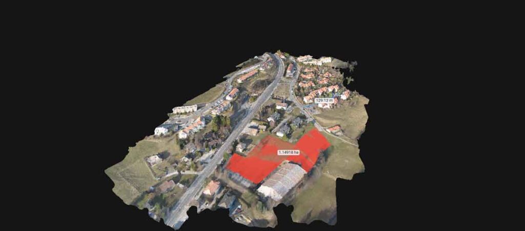
In the world of geospatial data, the best way to visualize a city is by applying depth rather than just a flat plane surface, this is known as 3D modeling.
Geo surveying services has the capability of producing 3D city models at various levels of detail. These city models can be used in various applications.