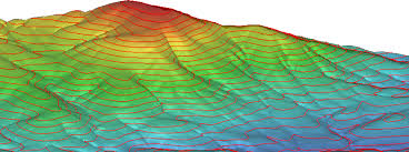
When it comes to elevation, we have three different ways to model elevation.
- DEM – Digital Elevation Models
- DSM – Digital Surface Models
- DTM – Digital Terrain Models and even
GeoSurveying Services has a wide experience in the generation of accurate digital terrain and surface models that are used in the production of Orthoimages, 3D city modeling, volume computations, drainage, water flow directions, and many more.